Tuesday, October 11, 2016

Estcourt Station, Maine: 2 - On the Border of Nowhere

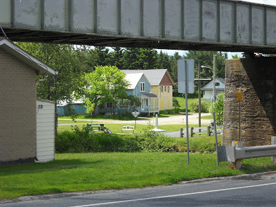
Estcourt Station Maine homesThe international borderline between the US and Canada meanders through Estcourt Station, Maine. Sometimes the border is on one side of the street, and sometimes the other. Homes are cut in half by it. And properties. Bedroom on one side of the border, and vegetable garden, the other.

What is life like in Estcourt Station, Maine?


For starters, let's say that you wish to go somewhere. Somewhere besides the Great North Woods. You need hardware or groceries. 

border town estcourt station maine
They have those things. In Pohenegamook, on the Canadian side. So, you check in with the Canadian border guard booth nearby. Then you do your bit of shopping. Hopefully you speak French. And have Canadian money.

After shopping, you check back in at the US crossing station about a half mile down the other way, toward the North Woods. A little annoying, but doable.

However, these are not 24/7 crossings. Not by a long shot. They are open from approximately 9 AM to 5PM on weekdays. That's it. 

So, what is one to do on an evening? Stay home? Watch movies? That's about it. You can fish or hike in the woods, of course. Go hunting when that is in season. 

But not leave the USA. Not until 9 am on a week day that's not a French Canadian or American holiday.
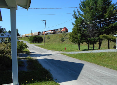
CN railway nearby on raised berm

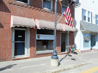
USPS in Canadian border town


Friday, October 7, 2016

Estcourt Station, Maine: 1 - On the Border of Nowhere

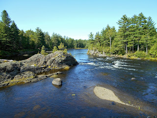
View from Canada over St. Francis River
A view of the north end of Estcourt Station from the Canadian side.
Our friends own a home in a unique place. It is in a tiny town on the border of Maine and Quebec. It is, in fact, the northernmost town in New England called Estcourt Station, Maine.

The international border between Canada and the USA was established by the Webster–Ashburton Treaty in 1842. Yet it wasn’t properly surveyed until much later. (I couldn’t find out exactly when.) The result? A few homes ended up on the wrong side of the border. And some were cut in half.
Quebec border town
We stayed in the blue house. The border is across the street. 

Can you imagine it? Living on the American side, there is nothing besides the Great North Woods of Maine. And a gas station. Looking out from the front porch of this home on a residential street, across the street is Canada!

Estcourt Station's south side leads off into the vast woodlands of northern Maine. However, Estcourt Station is also positioned on the southern fringes of a lovely little French Canadian village. That village has the unique moniker, Pohénégamook.

Main trunk line in Estcourt Station Maine
Canadian National Railway train, coming through!
Close as it is, Estcourt Station lacks a water view. The reason for that is that is on the wrong side of the tracks, so to speak. The Canadian National railroad sits atop a big berm. That tall hill blocks any potential water view. It also acts as a barrier of sorts between the two countries in this particular spot.

Trains come through regularly. As a main trunk line, they run night and day. If you have lived in a large city, you know what I mean. We lived in Brooklyn for many years and became used to the regular rumble of elevated trains.
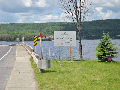
Pohénégamook Quebec Canada
Lake Pohénégamook
Lake Pohenegamook Quebec Canada
Sunset on Lac Pohénégamook, on the other side of the railroad tracks

(To be continued.)

Thursday, October 6, 2016

Katahdin Woods and Waters - 3

There is a canoe put-in at Whetstone Falls. We spoke to a pair of canoeists. They had spent some time exploring the east branch of the Penobscot River in the Katahdin Woods and Waters National Monument. The weather has been unusually dry. The river was low. The canoeists stated that "portages are overrated."
New Maine national monument

We asked how they came to be here. The national news reports had piqued their interest. After some online research, here they were, all the way from New Jersey, to check it out. 

We exited loop at about 2:30 pm and arrived back in Millinocket at 3:45. 
The economy of northern Maine has been hard-hit in the past fifteen or more years. Nothing has replaced the great paper mill economy. 
Longing for that bygone era, some local residents have been resistant to any change. What would anyone want with all that land, anyway? Why not just leave it as it was?
old paper mill landThe local residents have had special access to the paper mill lands for decades, even generations. With the paper mills struggling or gone altogether, their once-vast land holdings have passed on to others. 
If there is nothing up there, then why get upset about preserving the land? Yes, they might lose their personal, private access to some of the so-called "junk" land.
Maine landowner hates new national parkBecause of these issues, you will see some negative signage along the way. The local residents have already lost the battle and likely the war against this change. But they aren't going down without saying their piece.
Much of the Katahdin Woods and Waters land abuts Maine's other treasured wilderness, Baxter State Park. Percival Baxter bequeathed it to the state, "forever wild." Will the federal government eventually acquire that and make one huge wilderness park in northern Maine?
Only time will tell.

Wednesday, October 5, 2016

Katahdin Woods and Waters - 2

Nps Maine
Mount Katahdin, highest point in Maine and north end of the Appalachian Trail
We left Millinocket for the new Katahdin Woods and Waters National Monument at about 11AM on Labor Day. We hoped for an al fresco lunch in the park. We weren't disappointed. 

At 12:30 PM, we entered the 18-mile Katahdin Loop Road. At 6.7 miles in, we stopped at a fabulous panoramic overlook. A small group left as we pulled in. After that, we had this special spot completely to ourselves. 

Katahdin Woods and Waters National Monument
Spectacular lunch spot
My mother said that it was the most spectacular lunch spot she had ever been to. Two basic wooden displays outline the visible mountains and other major features. Besides three picnic tables, there is a clean vault toilet.

The overlook faces west toward Mount Katahdin. It's the tallest mountain in Maine, as well as the northern terminus to the Appalachian Trail. 

I imagine that it would be interesting to watch storms coming in from the west with such a prospect. However, today was sunny without a cloud in the sky.


We wended our way around the loop. There were some other nice views, but nothing that topped the prospect of where we ate lunch. 

This park is intended to be much more than a loop road experience, however. There are hiking trails galore, canoeing, snowmobiling, horseback riding and lots more. Check the official park sources for more information. 

Sketchy bridge
As we approached the sketchy bridge on the return via Swift River Road, there was a Jeep blocking the other end. Pausing to decide if crossing the bridge was really a wise idea, they pulled aside to allow us to cross the one-lane affair. We stopped and gave them the assurance we had received from the park volunteer as to its safety.

The folks from Elliotsville Plantation have done an admirable job of making their gift of a new National Monument hit the ground running, so to speak. The roads, although basic, were very doable. The vault toilets were clean and stocked. There was signage. Yes, they are working on a few projects, but that is to be expected for a park that was less than two weeks old! (Here is the website of Friends of Woods and Waters.)

We flushed a spruce grouse as we made our exit. Rarer than their cousin the ruffed grouse, they are protected from hunting. 

We pulled in at Whetstone Falls. I got out to view the East Branch of the Penobscot River, which is a dividing line of sorts for some park activities like hunting. 

(One more installment to follow.)

Tuesday, October 4, 2016

Katahdin Woods and Waters - 1

On August 24, 2016, an announcement was made by US president Obama that will likely change northern Maine forever. A new national monument has been created called "Katahdin Woods and Waters." Tracts totaling 87,500 acres were donated to create a new park!
What makes this place so special? Is it easy to visit this wilderness? My parents live in a nearby town. We decided to check it out.

200 Penobscot Avenue
New NPS office in Millinocket
The NPS has set up an office with information about the fledgling park. It is located at 200 Penobscot Ave in Millinocket. We spoke to a pleasant and knowledgeable volunteer. She shared some valuable tips to help with our visit.

https://www.nps.gov/kaww/planyourvisit/maps.htm
Fall 2016 new National Park
Our Dakota truck was visible there in the window with my elderly parents inside. She assured me that we should do fine. She said that she had even seen two Priuses driving in the park, although they don't recommend low-profile vehicles at this time (fall, 2016).
The volunteer kindly marked a few things on a map. There is a bridge that looks sketchy. It is fine. There is only one set of picnic tables in the shade.
With our map, lunch, parents, and newfound information, we made our way north from Millinocket on route 11. It is worthy of its designation as a Maine Scenic Byway.
We overshot the left turn onto Swift River Road, as the sign is missing. The locals aren't exactly ecstatic about the new park. More about that later.
Swift River Road is a gravel road, which are common here, typical of northern Maine logging roads. A coyote crossed the road not far in front of us. It feels like wilderness, all right.
Katahdin Woods and Waters National MonumentOur trip was on a major holiday, Labor Day. During our whole time in the park, a couple of hours, we saw maybe seven other vehicles. The proportion was about 50-50 of in-state versus out-of-state plates.
(To be continued...)